Molluscs Hunt Wizards is a body of work that looks for markers and boundaries of experience and potential within desert and plains landscapes. Here is the blog of the 2014 research in Mongolia and Australia, for more about the project please click HERE.
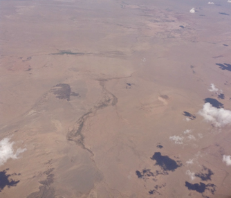
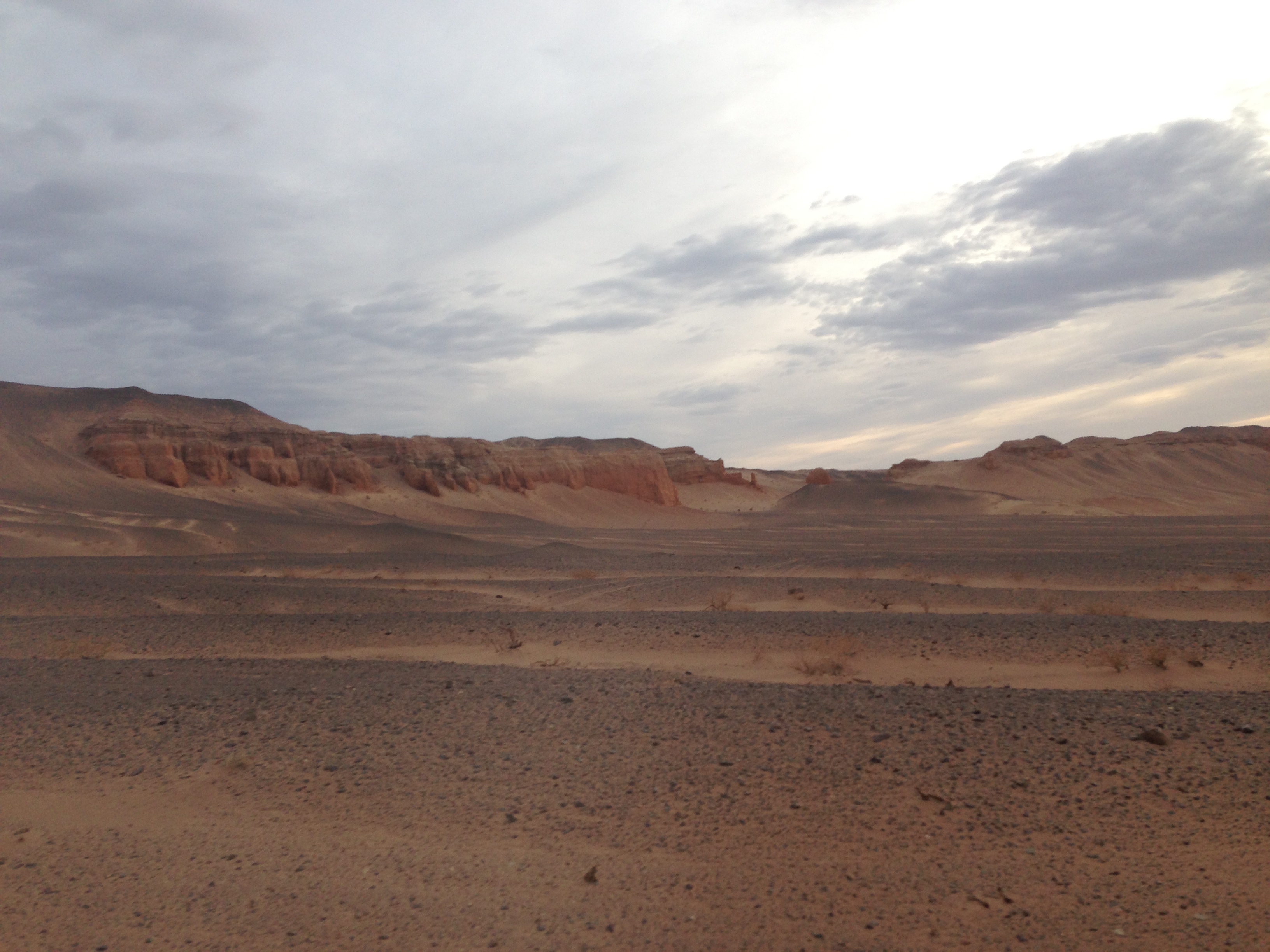
First sighting of the Gobi, August 2014,
![]()
The rail journey from Beijing was twenty seven hours through first, tree covered hills, then the industrial plains of Inner Mongolia before reaching the China/Mongolia border at 10pm. Here we waited for three hours while our papers were checked and the wheels on each carriage changed to fit the smaller tracks of Mongolia. Evidently the change of track gauge is to protect national borders, trains loaded with troops and artillery could not force their way through border control.
We arrived in UlaanBaatar in the early afternoon. It is an old city yet has a feel of impermanence. Things change regularly, and the dust of the desert blows through the Main Street. There is a sensation of being at a frontier. Bhuddism and Shamanism are the belief systems of the country. The big blue sky, the land and the spirits being the focus for respect and devotion.
On leaving UlaanBaatar the tarmac road surface soon gave way to the dirt tracks which we followed for hours. Soon after the city the landscape became scrub plains. We reached our first camp of Baga Gazriin Chuluu in the late afternoon and went straight to meet the ranger who protects and monitors all use of the locally protected area. In the ranger's Ger we were offered tea and snuff as a greeting, and his younger relative showed us around his Ger museum. Among his treasures were a flute from a virgin's thigh bone and a monk's mirror. Both found within the bounds of Baga Gazriin Chuluu.
![]()
![]()
![]()
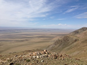
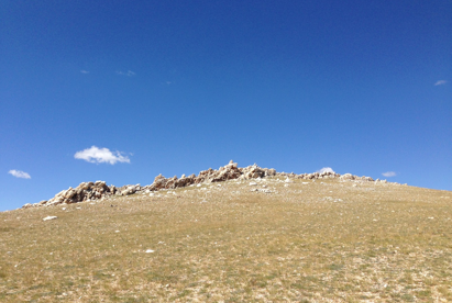
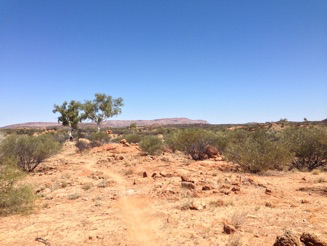
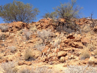
Setting up camp I collected dung to build a fire and the watched the sun set over a granite ridge. We walked around Baga Gazriin Chuluu throughout the next day seeking shrines, temples, wells and shade. The sun already is unforgiving, and I wonder how I'll manage with the southern Gobi where we'll head in the morning. I expect the horizons to become wider, and farther away.
![]()
![]()
There are few Tarmac highways in Mongolia. Those that do exist very often stop abruptly, unfinished, with no fixed timescale for extending them. Sometimes they seem to have been laid in sections, with completed elements up to a kilometre apart. Once we turn off from the Tarmac we follow dirt tracks. These have no signage, and I cannot decipher if they are fixed and known roads, or if they are simply the most commonly used route at any given time. Turuu, our driver, is always very confident in the route he is taking. It may dwindle to nothing bar a faded single track, yet we follow still, and always reach our destination.
I've asked Turuu how he knows his way. He tells me that there is no map for these roads. He just knows the general direction he wants to take and uses landscape markers as his guid
es. He will also stop from time to time and enquire in a Ger as to the best track or road to take, or stop a passing truck or Furgon and ask a fellow driver. Ultimately the path we take is decided by the terrain itself. Particularly in the Gobi the routes change with the weather, as a sudden flash of heavy rain might obliterate or create a path for vehicles. Likewise extended lack of rain dries the ground and softens the sand making it impassable for our van.
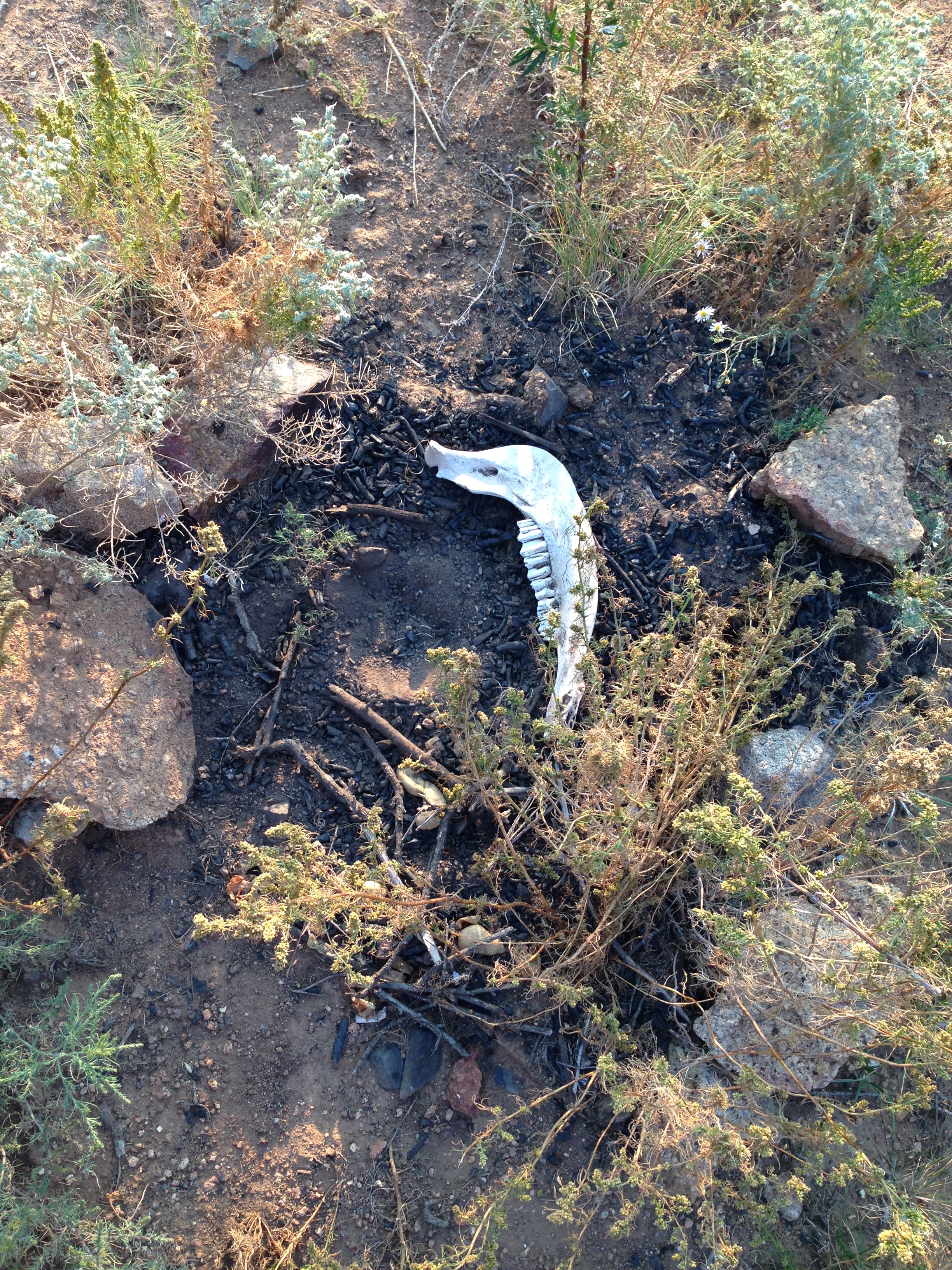
The six Mongolian Bactrian camels that took us across the foot hills of the mighty sand dunes of Khongoryn Els of course were not governed in the same way and could traverse dunes and scrub with equal efficiency. Although they shied at any skeletal remain we passed. Ribcages and skulls affected them the most, remnants of opportunistic wolf attacks, picked clean by vultures before bleaching by the sun. Understandably these reminders of the camel's own potential fate were unnerving, and the generally sure footed beast would quicken and stumble at each fatal site. Our camel guide, Bagi, himself was woken one night by the fearful moans of our camels, and in the morning soft but sizeable paw prints told of the wolf who had prowled our camp that night.
We travelled to the dunes from Dalandzadgad, capital of Ömnögov aimag (province), by one of the three main routes south through the mountains of Gobi Gurvan Saikhan National Park. We took the gorge road of Yolyn Am, which freezes and becomes impassable for six months of the year. In days past, before the Stalinist purges attempted to wipe out Bhuddism in Mongolia, a monastery, which stood at the southern gate of the pass, would provide shelter for travellers as they awaited the thaw. We stood and looked down upon the remains of the monestry, Gurj Lamin Khihiid. It was one of the largest in the country. There is nothing left but foundation lines in the grass.
From Yolyn Am we continued on, now again through dusty scrub, to finally arrive at the foot of the dunes of Khongoryn Els and stay a night with Baasan Khuu, the owner of the camels. The next day we began our five day trek which followed a path through the dunes to their south side, along their base, to come round through another pass at their westerly limits and finally return the camels to Baasan Khuu.
![]()
![]()
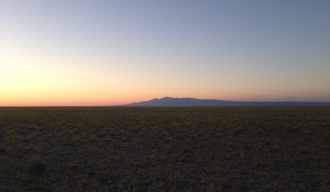
The dunes of Khongoryn Els sweep up against Zöölön Uul, a mountain range that is at the easterly reach of the Gobi Altai. You could say the dunes were a mountain range themselves. They are mammoth, the highest peak of sand being approximately 300m. They present the stereotypical beauty I think of in relation to a desert; sweeping lines and sharp contrasting forms lit by an unforgiving sun. There is certainly a beauty here, however, it is the gravel plains of the Gobi that stop my heart and leave my mind gaping in painful awe.
The plains feel harsh, presenting a seeming endless barren desolation that is difficult to comprehend. Yet I sit and gaze into their expansive horizon, as I do into my evening fire, seeing nothing and everything in the vastness of this place.
Each time we stop and I look around it takes a while for me to recover from the immensity and seduction of it all, and from the knowledge that I could not survive here unsupported.
Once I do look around more closely I find that there is much life and variety in this desert. The ground is covered in many small rocks, some igneous, some sedimentary. I am not sure what actual stone they are, although the range of colours allows me to imagine that I am walking on a land of jade, amber, lava, granite and coral. Small highly patterned lizards run in all directions, and mechanical-sounding flying beetles rise quickly from the scrub when disturbed by my steps. After dark we occasionally even see the rare mouse-like Jerboa darting around our camp. It comes swiftly and cautiously into the light of our lamps to look for scraps of food and then hides in a shadow to eat. A creation legend says the Jerboa was once an archer's horse, and that the dark fluffy end to his long tail is a reminder of this.
I find it's very easy to believe in legends here, as though they are still required for survival in this landscape.
![]()
![]()
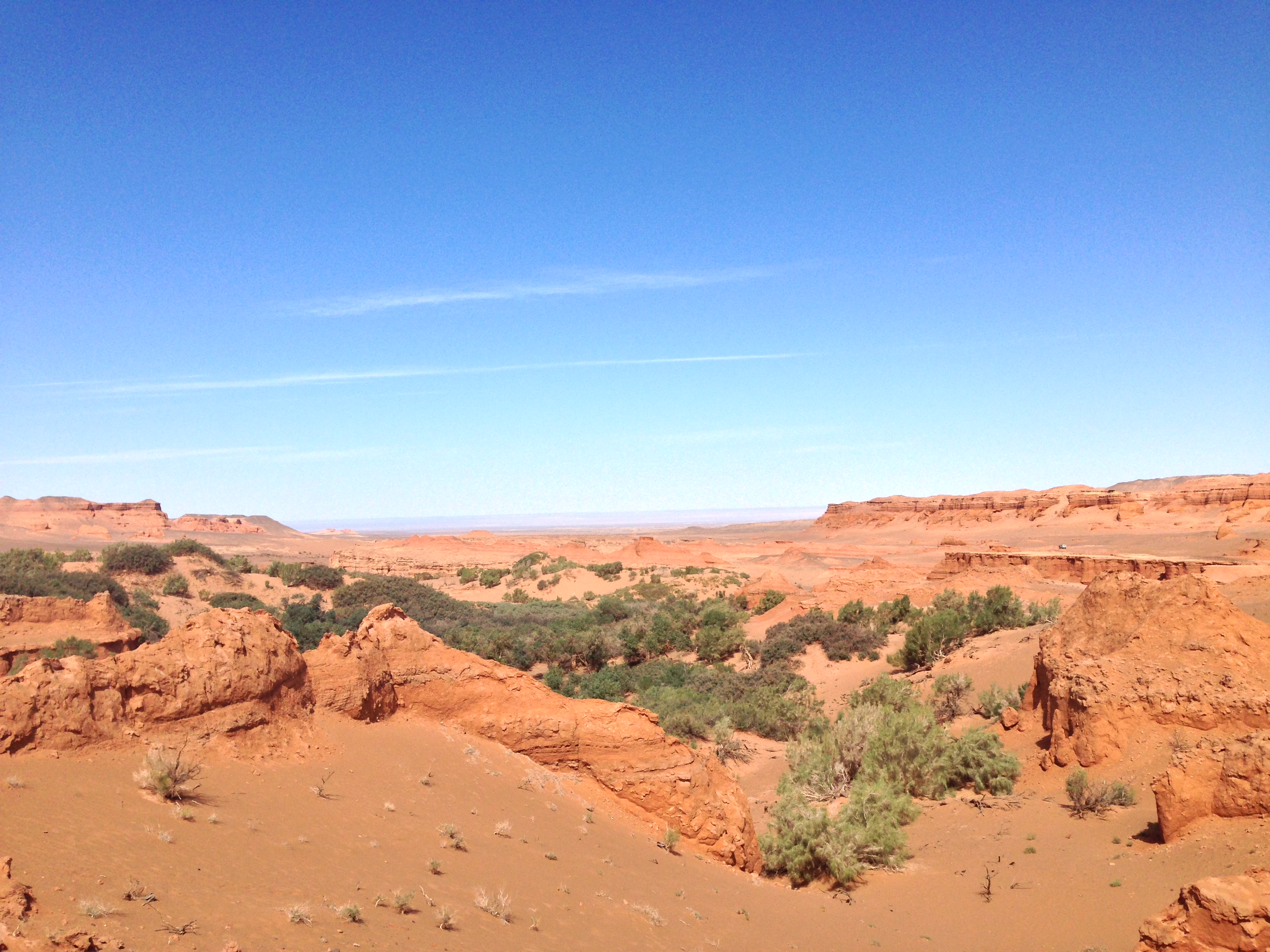
We travelled for days to find Kherman Tsav. All we had to go on was a vague area on an inexact map, and rumour. As ever there was no defined road, so we looked and hoped for the right dirt track, asking our way and trusting the information we were given, and Turuu's instincts of course. We had loaded up with extra water in case the spring we'd been told of was dry, or too difficult for us to find. We could travel for four days this way, after that we would be in trouble.
Kherman Tsav was an inland sea, until possibly 200million years ago. It is now dry, raw and visited mainly by scientists and hunters of dinosaur bones and fossils.
We arrived at sunset after our second day of driving. The landscape had quickly become more barren, the Gers thinned out, as did the livestock. What vegetation we saw was becoming less green and more brown. These plants must still be alive, somewhere, but they seemed dead. A bolt broke on the front right wheel of our Furgon. Tempers were being tested, particularly as we had taken some wrong turns and needed to double back on ourselves, covering more kilometres than we wanted.
Back on the road and we continued through the ever-increasing wasteland. The ground became looser and sand hills appeared. They became larger and more frequent and so our going became tougher with the softening ground. A number of times we all had to leap out of the van to give Turuu a better chance of getting through the sand. The sun was getting lower in the sky and we began looking around and wondering where we should camp. Turuu, however, wasn't prepared to stop yet. He was insistent that we keep going.
After another hour the sand hills had grown on one side of us to be well up to twenty or thirty metres in height. From a white/grey colour they had become more pink. Soon the dunes gave way to pink cliffs, which grew again in height. The sun was close to the horizon and still we drove, our Furgon's shadow trailing long behind us.
Then the cliffs to our right turned a corner, which we followed, and found ourselves on the edge of an enormous valley of red and pink canyons, cliffs and rock stacks. We jumped out of the Furgon and with jaw-dropping awe began to explore the land before us. The setting sun seemed to bring fire to the valley and everything around us was aflame with orange and red light. We had most definitely arrived at Kherman Tsav.
That night our meal and fire were accompanied by a warm and peaceful satisfaction.
![]()
![]()
Sleeping in this vast canyon made the loneliness of our location more profound. My fire gave me a sense of protection, but also emphasised the need to be watchful. The ever-present wolves would, in my mind, be looking down on our camp and laughing at their easy meal. No doubt it is these thoughts that led to my unsettled sleep, which I eventually gave up on. I sat contemplating the vaulting stars and how this particular place of now cold sand seemed to be so complete with the great arching night sky. The darkness bowing down to meet the sides of the canyon, the coldness of space rushing through the sand following the course of the satellites that circle the earth.
Eventually I crawled back into my tent and the warmth of my sleeping bag. I fell easily and peacefully into sleep. When I woke the next morning camp dismantlement was already under way. We were to walk around and more deeply into Kherman Tsav to see what we could discover about the land. What we found was completely unexpected, a lush oasis with reeds, shrubs and trees. There was no evidence of a spring so we guessed that the water was stored deep underground and replenished by seasonal rain, frost and sometimes snow. The absence of a running spring meant that we could not fill our water carriers, so would still need to head on quite soon. Before doing so we had time to explore further, both the oasis and surrounding red gorges.
![]()
![]()
We split up to cover more ground, each following different routes through the wide canyon, and the gullies which lead from and to it. No matter how far we explored there was always another route to follow, and then another. The colours of the rock varied, through a bright burnt orange to a pink and then softened yellow. Cliffs towered up at our sides and then a ravine would open up ahead. At other points small mountain ranges grew out of the sand, then a solitary stack would rear up and stand strong on a plateau. I marvelled at the changing scale of all these features and at the forms they took. Wondering if they were still being sculpted by the wind that roars and whistles through Kherman Tsav all the way from Siberia, or if these structures have remained true to the forging tides of an ancient sea.
Through our walking we discovered that the rock of the canyon itself was quite insubstantial. We tried to climb a peak but its side began to crumble and flake, trying another the same thing occurred. So, we realised the fragility of the place.
Kherman Tsav is marked, albeit vaguely, on a regional map, tour companies advertise that they can bring you here, Lonely Planet notes it as a highlight of the region, however, very few, Mongolians and non-Mongolians alike, actually make it out here. Of those that do, some use the remote, and already seemingly scared, landscape as an extreme trail bike park. Tyre tracks and the cut of sharp turns evidence their exploits, and I feel that I can hear them tearing past and through the maze of Kherman Tsav. Riding high on their own echoing thunder and the freedom that distance from 'life' and a watchful eye provides. These may be a take on the wizards that I've sought. Needing to test their limits no matter what the fall out, and so coming to a place where they can travel far and realise their potential. This site, of any, certainly has enough power to share.
We see no such adventurers while at Khermans Tsav or, on our days of travel to and from. We have the luxury of having this magnificence to ourselves. Just six of us, with no one else close, for miles and miles and miles.
Kherman Tsav throbs with 'traveller myth'. I naturally shy from experience tick-boxing, and feel frustrated at the competitive conversations that I overhear and am sometimes approached with, particularly at hostels. However at Kherman Tsav I did have an overwhelming sensation of having achieved something important by just being there. That it was somehow at the heart of things. It is not geographically in any middle, on a political map you'll find it close to the edge of Mongolia, and the beginning of Chinese territory. Even if you consider the Gobi as a whole, which spreads across southern Mongolia and Inner Mongolia*, Kherman Tsav is not anywhere that could be defined at the centre. Perhaps the heart of things that Kherman Tsav presents is more personal. This is the mid point of our journey through the Gobi, and in the search for markers of potential and experience it has indelibly etched itself on my journey. I certainly feel that a stage of my hunt is over.
Leaving Kherman Tsav it seemed the land became greener more rapidly than it grew dry on our way out. Perhaps it's just that the road back home is always quicker, and because we now know the way. We soon found a spring to replenish our water carries, and from which we could wash ourselves and our clothes. Turuu of course focused on the Furgon, wiping the pink dust from its windows and body, so that we could all continue our journey slightly more sparkling in the Gobi sun.
* Inner Mongolia is now politically part of China, but this area was all Mongolian until the early C20th.
![]()
![]()
It felt like our drive now was all about leaving the Gobi. Even whilst we were still there within the vast and varied desert it seemed that we couldn't avoid the sensation that we were just on our route back to UlaanBaatar. Conversation became about next-steps and life post Gobi. I felt like I wanted to stay here forever and was very resistant to thinking about the weeks ahead. Yes we had passed the half way point, but the Gobi wasn't finished with us yet. Our path back to the city promised more surprises and jaw-dropping vistas which would hopefully shake the glum.
A couple of days out of Kherman Tsav we drove through a smaller, paler, replica of the majestic red canyon. Bugiin Tsav offered cliffs, canyons, sandhills and plateaus, but now they were white, grey and possibly not quite as grand (we'd been spoiled).
The next day, following Bugiin Tsav, the terrain seemed to become incredibly green and lush, with small hillocks truly rolling by the windows of the Furgon. We stopped at a Ger for directions and tea. As soon as we had jumped out of the van I realised that the green land was in fact still full of small sharp rocks. It was just that now there were so many more small plants pushing their way through to the sun, which gave the verdant appearance.
I walked around this new landscape for while taking in the change, and noticed a very particular stream of rock breaking through at the tops of the hillocks. It was more like slate and your eye could follow the streams of it quite clearly, watching for where it would breach and rise up through the ground. Throughout my travels so far I had inevitably made associations with the vast dry desert plains and huge oceans, and here again the land suggested the movements of the sea.
We followed the direction of this slate stream as it seemed to grow into a mountain range. Joined by a soft pink granite, the stones together became the range of Ikh Bogd Uul, highest mountain within the Gobi-Altai. We camped at the base of some foothills, amongst the slate and granite rubble, and fragrant herbs that gave a balmy scent to our dung fire.
The next morning we climbed up into the foothills chasing one peak after another. Standing at 3,000m* had the sensation that we were looking back on the story of our journey. It was exciting to walk along the granite ridges and have the wide sky buffeting us with its fresh wind, reddening our cheeks and whipping our hair. Some joy had been injected back into us, and like dogs and children on a windy day, we fairly ran down the hills with smiles on our faces and all despondence gone.
Driving around the impressive range of Ikh Bogd took some time. We stopped for supplies at a village where I played a game of throwing darts at balloons. Ten chances were given, you needed to burst five balloons for a prize. Sadly I have to admit that I failed, only popping four of the brightly coloured inflated bags of rubber. But I gave the host of the game, and his younger siblings a good laugh!
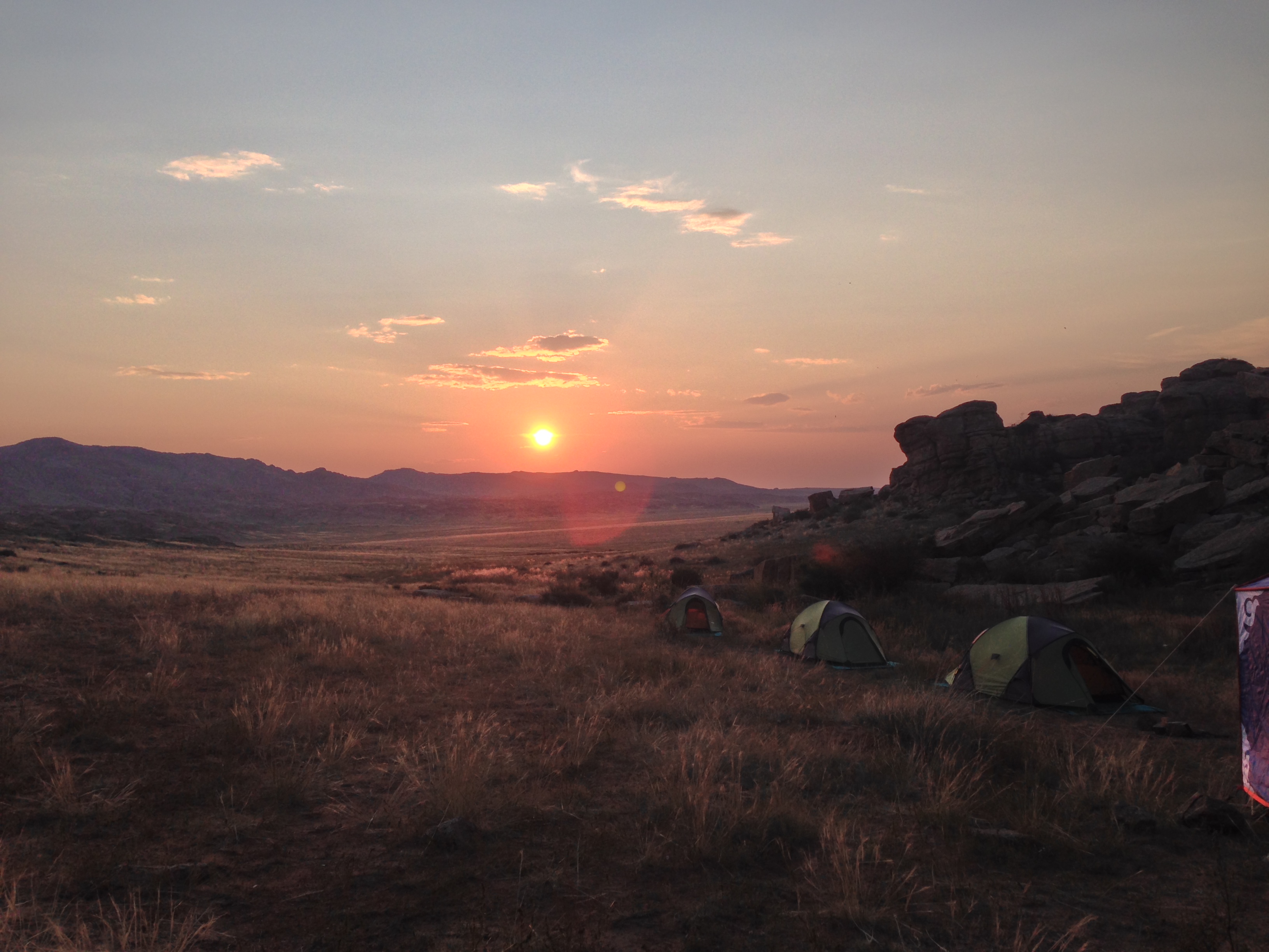
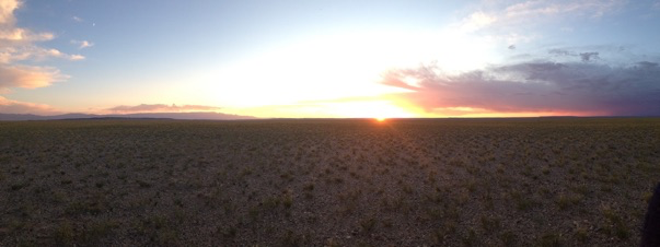
Much later, close to sunset Turuu pulled up in the middle of a rubble plain. This would be our camping spot for the night, and we learnt the last of the Gobi for this trip. It was a spectacular spot. A sand, Saxel and camel dung plain, with Ikh Bogd standing impressively to the south, and the peaks of Khangai Nuruu national park to our north. We hurried to pitch our tents, and ready ourselves to watch the sun set perfectly framed by the scene around us. Some clouds had come over from the North East and were now glowing with an almost fluorescent pink. Our last full day in the Gobi.
* Mongolia has a high elevation and the starting point of our walk was approximately 2,500m.
![]()
![]()
I woke to watch the sun rise on that same plain. I don't think I'll ever get over the peacefulness that this green desert offers. Its wide and open sky that I've felt I could drown in, the broad and far horizons that have given me space to breath, and the pace of our lives here that has given time to acknowledge these things.
As we carried on our road again the terrain kept changing. We camped by a waterfall, rode through a forest and swam in a river. The weather became colder and fires were lit in the Gers in which we stayed. We met some part-wild horses with zebra-stripped legs and watched the Yaks milked who provided the cream for a clotted cream tea.
We stopped for a while to visit KharKhoum*, the ancient capital of Mongolia, and the still practicing Bhuddist temple there. The long walled grounds of the temple seem to suggest the scale of the country, and in the monks' peaceful defiance and survival, something of the bleak beauty.
On one warm and handsome day, close to the end of our trip, we stopped to lunch near a Ger surrounded by smooth green hills that were crested with gleaming white ridges. I took a twenty minute walk up to one of them. As I reached the top an eagle lifted off from his perch above me and soared off into the blue. I watched him climb through the sky and then myself climbed up the rock to see the land from his view.
In the next days I would travel back to Beijing on the Trans-Mongolian Express. I would spend some days in that city visiting museums and galleries. I would take a hike along the Great Wall of China, built to protect dynasty after dynasty from the Mongolian hoards**. Within a week I would be flying to Melbourne and beginning a new search for markers, boundaries, and routes through another wide land. How quiet and still it was to just stand on that bright white outcrop in the Mongolian sun looking after the eagle who had now flown out of the reach of my eyes.
* and the name of my favourite Mongolian beer.
** a fact that many Mongolians I met were still laughing at.
![]()
![]()
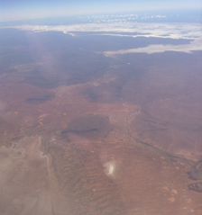
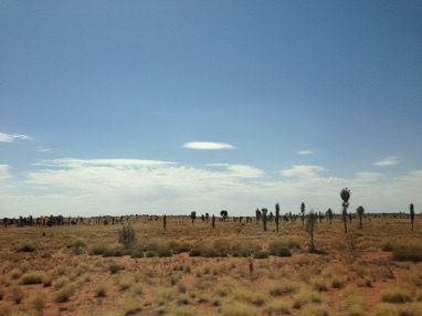
Australia. How BIG is Australia?!? Flying from Melbourne Tullamarine to Uluru, Connellan Airport takes three hours, and that's only half of it!
The flight took us over white salt lakes and dry dry orange land. At first this landscape appeared to be gridded by lines denoting cattle grazing and ownership, but there was a point where the rectangles of land division ceased and the neverendingness of the landscape felt more apparent. It was a surprise and relief when this happened. Since leaving the Gobi I had been itching to be back in large open space... Unfortunately I was to discover that it would be a while yet before I found that again.
Nevertheless, in my naïve state aboard this flight to the 'Red Centre', I was able to look down upon the Australian outback and feel enthusiastic about where I was headed.
Something that particularly struck me was how the scrub appeared from this perspective. So many green-blue circles of varying sizes covered the land. I didn't yet know the names of these plants, beyond the (to me) mystical Mulga and Spinifex, that I'd read about in Robyn Davidson's Tracks. It seemed instantaneous and obvious to relate the multitude of these circles on the land to the dots of the traditional paintings of Australia's first people*, regardless of how little I understood about the flora of this land, or artwork. Later on, while I was staying in Alice Springs, I was told by the curator at Papunya Tula Gallery that dot marks are often used as a filler for a composition. It didn't feel as though they were filler from this distant arial composition. Rather that they helped give definition to the burnt surface I was looking down on. Denser groupings of these bushes and trees gave a sensation of a greater rise and fall in the terrain than was actually present, suggesting some kind of rhythm or flow.
Landing at Connellan and then taking a shuttle to Yulara, or Ayres Rock Resort as it is still called, was a very real coming down to earth from. I was unprepared for a real-life Lassiter's.
The Yulara resort is listed as a town or village, which is where I got confused. This is no village that I understand, with independent retailers and accommodation providers. With easy movement in and out and inhabitants who might share their insights of where to get the best coffee and how to have the most economical visit. This was The Prisoner meets Neighbours. All was beige. There were timetabled Bush Yarns, Tribal Dancing and Dot Painting Workshops. There was a BYO barbecue, but you are only allowed to buy your cooking fodder from the bar that runs the electric BBQs. Contemporary easy-listening covers were piped everywhere from 7am to 11pm, and were occasionally replaced by a live version of the same thing. It was possible to 'escape' to the TV Lounge & Reading Room (why are they the same thing???) or to an outdoor Uluru lookout sand hill. I confess there was a pool, which I used and enjoyed, as it was practically empty from being apparently too cold.
Access to the Uluru - Kata Tjuta National Park is a reasonable $25 for three consecutive days, however physically accessing the park from the 'village' is a most unreasonable matter. Particularly for a solo traveller using public transport. All options for access to the famous and important rocks were tour-based and expensive. I just couldn't believe this was the case, particularly after the ease of accessing The Great Wall in China. I felt locked-down. I could have cried, in fact I think I might have done.
So, I decided to head to Alice Springs, where I felt sure I'd meet other travellers who would have experience and knowledge that I could tap into.
Travel to Alice was only possible via yet another 'tour'. So $160 for the six hour coach journey later I was on my way to the fabled town, just happy to be getting far away from Yulara and safe in the knowledge that a lifetime of travel between west Cornwall and London on trusty British coach and rail services will have prepared me well for this journey through the hot red sand of the Northern Territory on a package holiday coach that doubled up as the local ride. I was realising quite quickly that the boundaries and markers of this journey in Australia would be quite different to those I found in Mongolia. And that I would also need to draw upon and develop a whole different set of skills for navigation.
* The minute you arrive in the 'Red Centre' you begin to be bombarded by dot-painting prints on everything and anything you can think of. Authenticity is a whole other conversation full, unsurprisingly, of questions and contradictory answers. I can't help but think about culture and even day-to-day life things being for sale in my own culture. Who has ended up owning what, and how the hell do you get it back once it's been given/taken? Is it possible to police who accesses your own culture? And if you choose (is it even a choice) to use it to make some money then are you selling yourself? And would you recognise what was yours if someone else tried to sell it back to you? All these questions became far more 'in-my-face' in the centre of Australia than they ever were in the desert of Mongolia.
![]()
![]()
![]()
The Desert Oak or Allocasuarina decaisneana
I came across these trees standing up straight and proud, like skinny black leafless lines against the brilliance of the desert. They're hunting for water when in this state, their roots drilling down through the hard earth for many metres. So they're no indicator of any water that's accessible to humans.
A woman, who was cooking huge vats of curried dinners in the Yulara village canteen for teens on a school trip, told me with pride how efficient these trees are. They won't flourish until they find water. Until then they focus all their energy below the surface of the earth, so they appear lifeless, limp and to some ugly. Once they get to that much needed moisture however, and they begin to bloom. Spindly arms growing stronger and sprouting further arms and fingers. They begin to develop some green and then they resemble lollipops, whose sugared candy can sway in the wind.
Mick, a man who was driving a minibus from Yulara to Uluru and back, told the bus load of tourists that the Desert Oak didn't resemble an English Oak, but that "we're Australian and we can call it what the f*ck we like", which I thought was reasonable. He also told me that he hadn't "pissed for fifteen years", he was demonstrating that you should only need to sip enough water through the day to keep you hydrated, not enough to make you pee a lot. Although, after a pause, he said that he may have told me a lie. So for all I know he might even have been weeing all that morning!
![]()
![]()
Alice Springs
A few things about Alice Springs seemed strange to me on arrival. Among the things that first struck me were the restrictive alcohol licensing and the seemingly very divided communities of the town. Mainly the difference of indigenous and, predominantly white, post-colonisation settler communities. It felt like two towns living on top of each other. As though those in either community would go about their business regardless of the other, they could have been ghosts to each other. Maybe they were, I wasn't there long enough to discover. But the obvious split in the town, on the face of it at least was stark. Many of those staying in my hostel on Meuller Street experienced the same strange sensation of being an observer to this behaviour of otherness. We tried to find out what we could, but I think more time in the town is the answer, and we were all on limited 'tourist-time'. Ourselves adding another layer to the structure of the town's inhabitants.
After a few days I managed to settle into a rhythm with Alice. I visited the library each day for research and a quiet work space, I visited galleries, art centres, and the museum. And I tried to find a way to access the bush.
I'd hoped that I'd find fellow travellers in Alice who were equally frustrated by the lack of options for accessing the desert. That people would be inventive and group together to beat the system of tour operators. I did meet Monika, an energetic and forceful woman from Köln, who was as determined as I to travel independent of facilitation. We researched routes and 4wheeldrive deals. Devised a trip and made posters for hostels and posted on Facebook pages, Gumtree and other traveller sites, looking for fellows to join us out into the yonder. None answered. We worked out that others, less dreamily hopeful than ourselves, had realised the lock down and so booked onto the best value tour for their needs before they'd arrived in Alice. Itineraries were organised and alteration would be costly.
I myself had fallen foul of this by anxiously booking my flight to Sydney from Yulara ahead of time to avoid price hikes, thereby limiting my options for joining other trips out into the red. For instance a German fruit-picker who had driven over from Queensland in his fifth-hand station wagon, or even Monika. Who was joining Alice-based friends she'd made on the way down from Darwin to do some work towards the Freedom Flotilla: Lake Eyre to West Papua* project.
As these people made their way in their own directions I, left again to my own devices, thought about how I could look for the space I wanted, and find the wizard dynamic that would stretch out into the hot bright blue.
There were a series of walks from the town into the bush around the Telegraph Station. I took to walking some of these, following bike tracks for a few kilometres, close to the beginning of the famous Larapinta Trail. These trips gave me quiet space, and an introduction to the sounds of the lizards, birds and insects here, and of my own crunching footsteps. There was no flatness during these walks. Rocky dirt gullies, low ridges and dry sandy riverbeds were the terrain. I aimed to be done by noon each day as the heat would grow harsher as the day wore on, and my rucksack heavier. I dripped with the sweat of not a great deal of labour, and felt that rather than drinking my water I might as well have just thrown it over myself. The colour and heat of the walks, however, gave me energy and a sense of being on a road to where I wanted to be.
Later in the week I chose to take an organised trip out to the Kangaroo Sanctuary**, run by Brolga, to get a bit further out of town and learn more of the habits of Kangaroos and Wallabies. The positive attitude of that place where I watched the sun set over the red, blue, green of the Alice outback, coupled with Brolga's determination to make a difference, restored some wonder and faith to my hunt. Maybe there was a new way that the molluscs and wizards would flex their muscles and introduce me to their modes of action in this land. In this giant island that is so different and yet so similar to my own.
*Inspiring and energetic the Freedom Flotilla took waters from Lake Eyre to West Papua, in an act of solidarity and positivity. The waters of Lake Eyre are told to originate from rain falling upon West Papua and therefore represent a bonding of land, life and people. You can find out more about the campaign here, www.freedomflotillawestpapua.org, as they continue to raise awareness of the oppression of the Indonesian occupation of West Papua.
**the sanctuary was set-up and is run by Brolga's of BBC Kangaroo Dundee fame. He's very tall, and very dedicated to spreading an understanding of how Joeys can be saved from starving in their dead mothers' pouches, by passing motorists just stopping to take a look. You can find him on Facebook to hear regular stories about the sanctuary.
![]()
![]()
![]()
Lassiters
Loaded up back and front with rucksacks I walked to my 6:40am coach pick-up to travel back to the Yulara village. I had swallowed my pride and accepted a fate of sorts.
Journeying back South down the Stuart and Lassiter Highways it struck me that this time, I was better informed about the landscape I was passing through. I had walked upon it, had spoken with people who lived by its codes, had read and heard stories (scientific and cultural) about its formation and viewed artwork that referenced it. My sense of its huge capacity for eliciting notions of freedom was growing. This time, travelling through the land of salt lakes and mammoth rocks, I was excited. The next morning would be an earlier rise and I would finally make my visit to the Uluru Kata Tjuta National Park.
I would have two whole days at Yulara. The morning of the first would allow me a walk through the mounds of Kata Tjuta, but all of the second, from sunrise to sunset, would be spent at Uluru. Finding the most affordable route or way of doing something had become one of the guiding points of this stage of my journey, as was finding ways to be alone in my walking. It required research through visiting tourist information points, libraries and websites, as well as incidentally, through talking to people and asking questions in shops, hostels, bars or on buses. I was always ready to learn something that might be helpful to my journey. Unfortunately I also found that there were often people or systems ready to block the most solitary or affordable path, but I treated these blocks as part of the terrain and substance of the trip, and I navigated them as such.
I had discovered a company* that offered straight forward return trips to both Kata Tjuta and Uluru. For the first day's trip I would be taken at sunrise in a mini-bus with other tourists from Yulara to a viewing platform within the national park where we would be given 40 minutes to watch the sun rise behind Uluru and cast its warm glow on the the turtle forms of Kata Tjuta. We would then be taken to Kata Tjuta and left for four hours to walk through, what has been named, The Valley of the Winds. A narrow 'jurassic' valley that opens up to a vista of plains. Standing in it I was reminded of savannah that I've only ever read of, or seen through TV and film, which did threaten to hijack my imagination and override the current experience. But in the end what was happening in the now, filling my eyes and ears and burning itself into my skin was more powerful than the these borrowed memories.
*Mick's bus, of my Desert Oak posting.
![]()
![]()
![]()
Minga
** Minga - ant in Pitjantjatjara, name for tourists who climb Uluru
1. Small black ant. 2. Cover term for various species of ant, ants in general. 3. (Uluru Slang) tourists.
Minga alatjitu, (lit. Just like ants!) used to emphasise the huge size of a crowd or other gathering: Anangu winki nyinangi - minga alatjitu! There were so many people there - teeming like ants!
Minga pulka, lots of ants (pulka 'big')
I learnt about this term from the ranger when when I spent the day at Uluru. What fascinated me most about the term Minga was that in Cornwall a common term for tourist is Emmet, a Cornish dialect word for ant. It's not that surprising that two cultures from opposing sides of the world should relate the movements of swarms of tourists to those of the ants that invade store cupboards and use any crack or crevice to their advantage, but learning about it gave me a more of an understanding of how I was trying to access the land of this country and where my approach to path-finding was coming from.
![]()
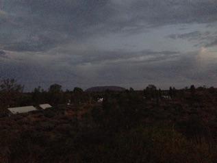
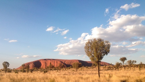
Uluru
Tuesday 30th September: A little after sunrise I began the 10.6 km walk around the base of Uluru, choosing to go anti-clockwise in some hope that I'd have more space for myself. I took my time, stopping often to watch birds and investigate the nooks and crannies of the rock. It's apparently quite common for first time visitors to expect an almost perfectly smooth and even surface to the desert behemoth. It is anything but. As I walked its circumference I quickly became aware of it being a form of folds and movement, with water and its traces everywhere.
There were many places to find information about the formation of Uluru; Mick the minibus driver, the Ranger at the Cultural Centre, the museum in the Cultural Centre, and then hearsay from Alice to Melbourne ere was always someone with a new nugget to share. I was told that the rock had at some point turned. That a number of cavities on one side of it were made by water running and filtering through it. That these holes that pepper just one side of the rock were at one time beneath it. I was also told that it was like an iceberg, with at least twice its mass beneath the surface of the earth and therefore not visible to us at present. That upon its top are watering holes and small areas of woodland and bush, fed by rainwater. Walking around Uluru's ground level belt it's possible to walk into some of its rock folds and within them find watering holes fed by waterfalls that add credence to the tale of green worlds on its uppermost surface. Green worlds that I cannot substantiate as I will not climb the rock to see them*. I do sit and walk in caves perhaps created by long past rushing waters, and which are inscribed with detailed instruction to youths on hunting and other life pursuits. Their floors telling a story of domesticity, scars of grain and seed grinding and scorching from long past fires.
All of the above added to the sensation of this rock being a planet of its own. Spinning slowly, when timed by the evolutions of the Earth, but perhaps at just the right speed for itself. Sitting snugly in the desert like a baring in a wheel that minds its business and does all that it needs.
I had chosen that I would spend the day at Uluru. The minibus would collect me at sunset, and so I had the time to take my time, to view the rock from the corner of my eye, from a cafe window, over the top of my book, whilst talking to a fellow tourist, whilst coming out of the loo. I was there for a day. I had no familiarity with the place. But I felt like I allowed myself the time to be slow with it and to be a little bit mundane, because when you're confined to the only shade around for six hours you forget to be alert and wowed at what is right next to you. And with that normality, and with water and shade becoming of greater importance than the spectacle, I feel like I may have been able to experience Uluru as just another piece of the Earth that is no more special than the granite of home but that with its size can remind of the importance of all those seemingly smaller parts.
At the end of my day I waited outside in the warmth of evening sun chatting to a suave and alert American Europhile who put me in mind of Peter O’Toole in Lawrence of Arablia. The minibus would collect me at 5:45pm, but until then I shared a warm conversation about the strangeness of the Yulara holiday village, of the majesty of Uluru and of the wonder of solo travel, of the time and peace it gives and of the short but life imprinting engagements one can have.
Dining tables were laid out in front of the Cultural Centre with white linen and silver cutlery. Uluru stood as a solid backdrop, but to itself I suspect the evening that was being prepared was no more affecting than a small meeting of ants on the surface of a sun-warmed piece of granite. Mick and the minibus arrived, and I headed off to a sunset viewing platform to observe the famous changing colours of Uluru in the fading light of the day. Lawrence remained at the Cultural Centre to drink chilled Champagne and eat what he recognised would be a very European meal in the heart of this very non-European place. And I thought about the seemingly harmless treats we allow ourselves and how historic paths can be reaffirmed by actions in the present.
* it is requested by the people of the land that visitors do not climb Uluru as it is a sacred place.
Molluscs Hunt Wizards is an ongoing project as part of Symbol Archive
First sighting of the Gobi, August 2014,
****
The rail journey from Beijing was twenty seven hours through first, tree covered hills, then the industrial plains of Inner Mongolia before reaching the China/Mongolia border at 10pm. Here we waited for three hours while our papers were checked and the wheels on each carriage changed to fit the smaller tracks of Mongolia. Evidently the change of track gauge is to protect national borders, trains loaded with troops and artillery could not force their way through border control.
We arrived in UlaanBaatar in the early afternoon. It is an old city yet has a feel of impermanence. Things change regularly, and the dust of the desert blows through the Main Street. There is a sensation of being at a frontier. Bhuddism and Shamanism are the belief systems of the country. The big blue sky, the land and the spirits being the focus for respect and devotion.
On leaving UlaanBaatar the tarmac road surface soon gave way to the dirt tracks which we followed for hours. Soon after the city the landscape became scrub plains. We reached our first camp of Baga Gazriin Chuluu in the late afternoon and went straight to meet the ranger who protects and monitors all use of the locally protected area. In the ranger's Ger we were offered tea and snuff as a greeting, and his younger relative showed us around his Ger museum. Among his treasures were a flute from a virgin's thigh bone and a monk's mirror. Both found within the bounds of Baga Gazriin Chuluu.
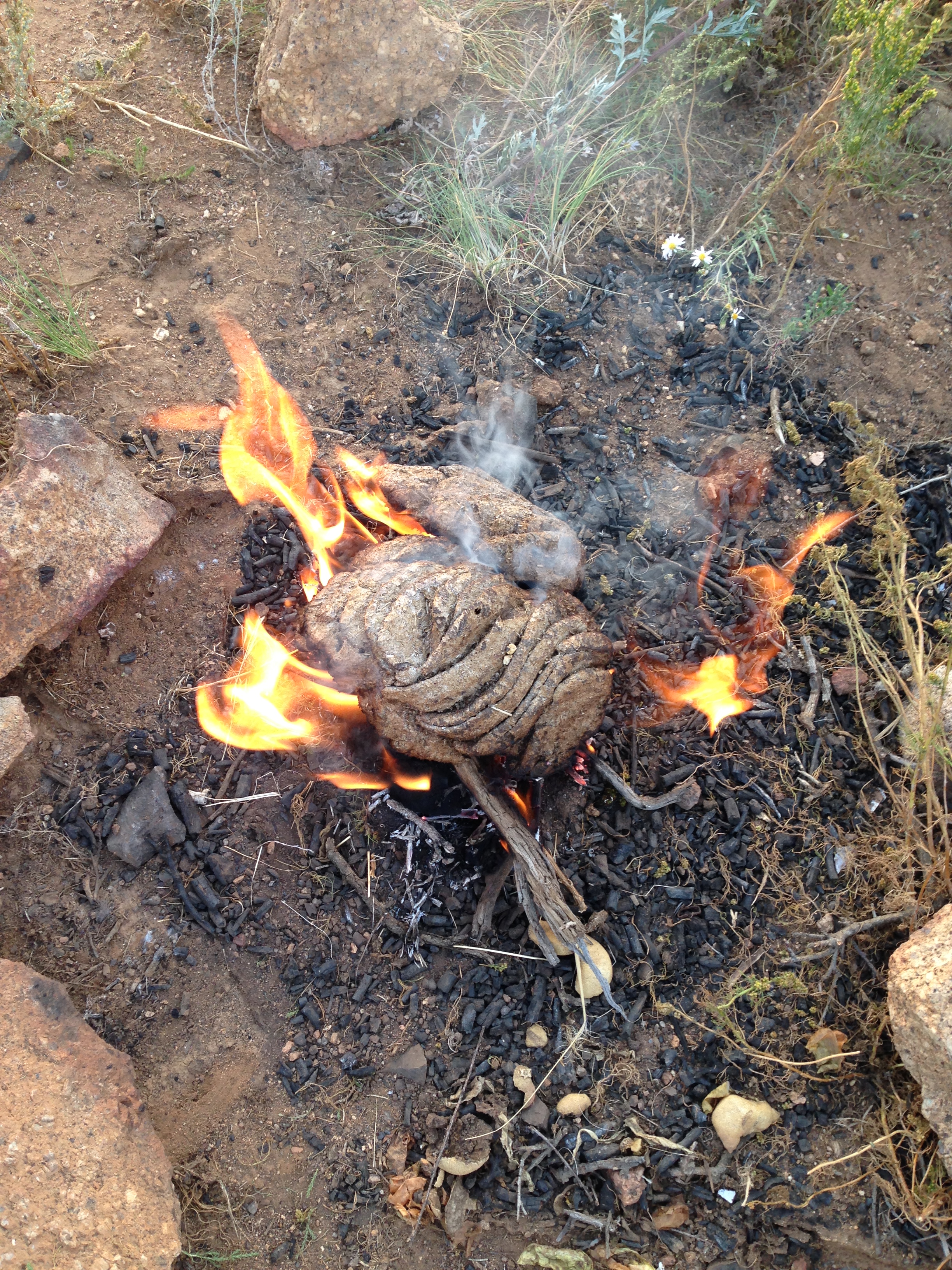
Setting up camp I collected dung to build a fire and the watched the sun set over a granite ridge. We walked around Baga Gazriin Chuluu throughout the next day seeking shrines, temples, wells and shade. The sun already is unforgiving, and I wonder how I'll manage with the southern Gobi where we'll head in the morning. I expect the horizons to become wider, and farther away.


There are few Tarmac highways in Mongolia. Those that do exist very often stop abruptly, unfinished, with no fixed timescale for extending them. Sometimes they seem to have been laid in sections, with completed elements up to a kilometre apart. Once we turn off from the Tarmac we follow dirt tracks. These have no signage, and I cannot decipher if they are fixed and known roads, or if they are simply the most commonly used route at any given time. Turuu, our driver, is always very confident in the route he is taking. It may dwindle to nothing bar a faded single track, yet we follow still, and always reach our destination.
I've asked Turuu how he knows his way. He tells me that there is no map for these roads. He just knows the general direction he wants to take and uses landscape markers as his guid
es. He will also stop from time to time and enquire in a Ger as to the best track or road to take, or stop a passing truck or Furgon and ask a fellow driver. Ultimately the path we take is decided by the terrain itself. Particularly in the Gobi the routes change with the weather, as a sudden flash of heavy rain might obliterate or create a path for vehicles. Likewise extended lack of rain dries the ground and softens the sand making it impassable for our van.
The six Mongolian Bactrian camels that took us across the foot hills of the mighty sand dunes of Khongoryn Els of course were not governed in the same way and could traverse dunes and scrub with equal efficiency. Although they shied at any skeletal remain we passed. Ribcages and skulls affected them the most, remnants of opportunistic wolf attacks, picked clean by vultures before bleaching by the sun. Understandably these reminders of the camel's own potential fate were unnerving, and the generally sure footed beast would quicken and stumble at each fatal site. Our camel guide, Bagi, himself was woken one night by the fearful moans of our camels, and in the morning soft but sizeable paw prints told of the wolf who had prowled our camp that night.
We travelled to the dunes from Dalandzadgad, capital of Ömnögov aimag (province), by one of the three main routes south through the mountains of Gobi Gurvan Saikhan National Park. We took the gorge road of Yolyn Am, which freezes and becomes impassable for six months of the year. In days past, before the Stalinist purges attempted to wipe out Bhuddism in Mongolia, a monastery, which stood at the southern gate of the pass, would provide shelter for travellers as they awaited the thaw. We stood and looked down upon the remains of the monestry, Gurj Lamin Khihiid. It was one of the largest in the country. There is nothing left but foundation lines in the grass.
From Yolyn Am we continued on, now again through dusty scrub, to finally arrive at the foot of the dunes of Khongoryn Els and stay a night with Baasan Khuu, the owner of the camels. The next day we began our five day trek which followed a path through the dunes to their south side, along their base, to come round through another pass at their westerly limits and finally return the camels to Baasan Khuu.


The dunes of Khongoryn Els sweep up against Zöölön Uul, a mountain range that is at the easterly reach of the Gobi Altai. You could say the dunes were a mountain range themselves. They are mammoth, the highest peak of sand being approximately 300m. They present the stereotypical beauty I think of in relation to a desert; sweeping lines and sharp contrasting forms lit by an unforgiving sun. There is certainly a beauty here, however, it is the gravel plains of the Gobi that stop my heart and leave my mind gaping in painful awe.
The plains feel harsh, presenting a seeming endless barren desolation that is difficult to comprehend. Yet I sit and gaze into their expansive horizon, as I do into my evening fire, seeing nothing and everything in the vastness of this place.
Each time we stop and I look around it takes a while for me to recover from the immensity and seduction of it all, and from the knowledge that I could not survive here unsupported.
Once I do look around more closely I find that there is much life and variety in this desert. The ground is covered in many small rocks, some igneous, some sedimentary. I am not sure what actual stone they are, although the range of colours allows me to imagine that I am walking on a land of jade, amber, lava, granite and coral. Small highly patterned lizards run in all directions, and mechanical-sounding flying beetles rise quickly from the scrub when disturbed by my steps. After dark we occasionally even see the rare mouse-like Jerboa darting around our camp. It comes swiftly and cautiously into the light of our lamps to look for scraps of food and then hides in a shadow to eat. A creation legend says the Jerboa was once an archer's horse, and that the dark fluffy end to his long tail is a reminder of this.
I find it's very easy to believe in legends here, as though they are still required for survival in this landscape.


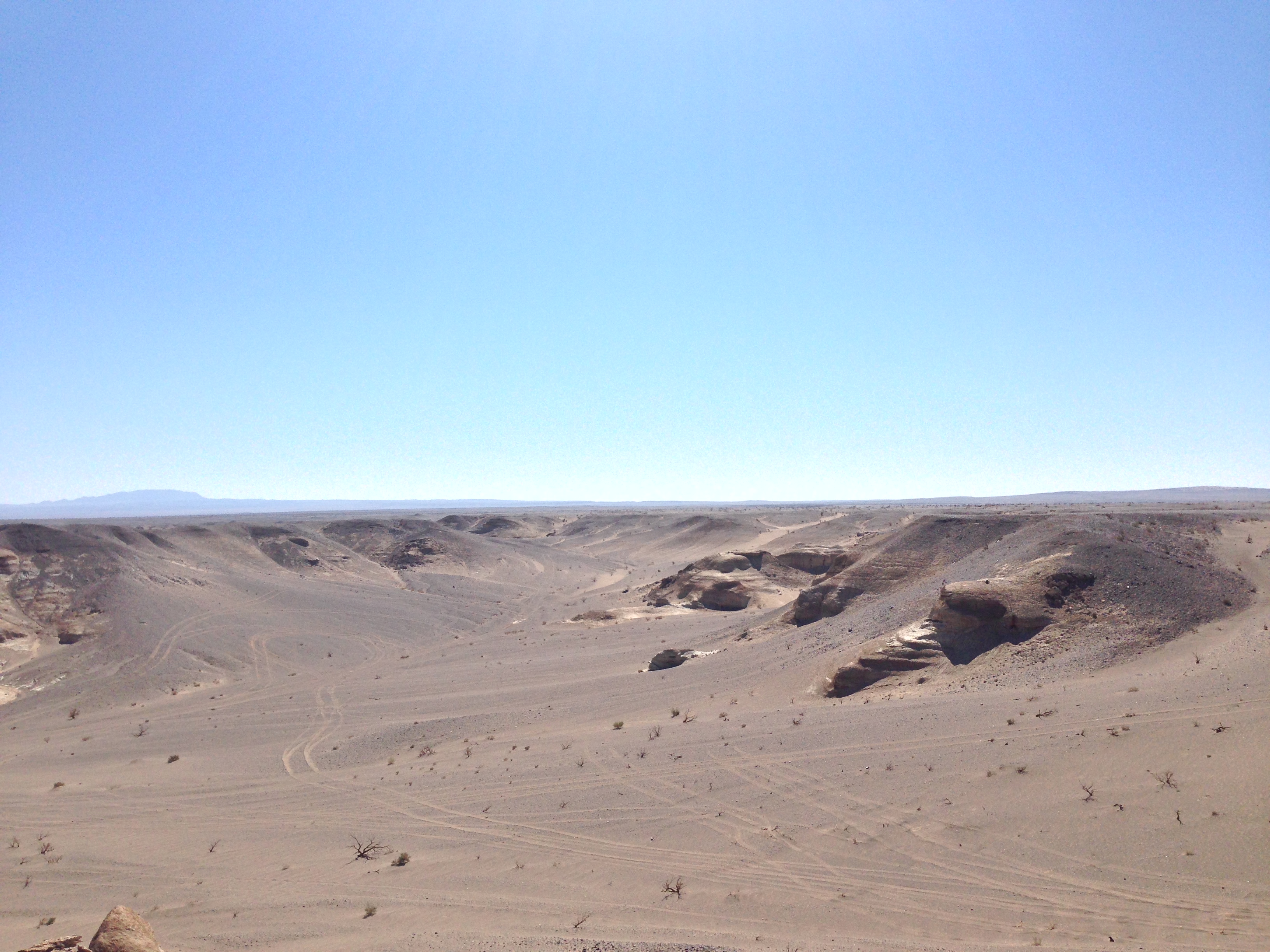
We travelled for days to find Kherman Tsav. All we had to go on was a vague area on an inexact map, and rumour. As ever there was no defined road, so we looked and hoped for the right dirt track, asking our way and trusting the information we were given, and Turuu's instincts of course. We had loaded up with extra water in case the spring we'd been told of was dry, or too difficult for us to find. We could travel for four days this way, after that we would be in trouble.
Kherman Tsav was an inland sea, until possibly 200million years ago. It is now dry, raw and visited mainly by scientists and hunters of dinosaur bones and fossils.
We arrived at sunset after our second day of driving. The landscape had quickly become more barren, the Gers thinned out, as did the livestock. What vegetation we saw was becoming less green and more brown. These plants must still be alive, somewhere, but they seemed dead. A bolt broke on the front right wheel of our Furgon. Tempers were being tested, particularly as we had taken some wrong turns and needed to double back on ourselves, covering more kilometres than we wanted.
Back on the road and we continued through the ever-increasing wasteland. The ground became looser and sand hills appeared. They became larger and more frequent and so our going became tougher with the softening ground. A number of times we all had to leap out of the van to give Turuu a better chance of getting through the sand. The sun was getting lower in the sky and we began looking around and wondering where we should camp. Turuu, however, wasn't prepared to stop yet. He was insistent that we keep going.
After another hour the sand hills had grown on one side of us to be well up to twenty or thirty metres in height. From a white/grey colour they had become more pink. Soon the dunes gave way to pink cliffs, which grew again in height. The sun was close to the horizon and still we drove, our Furgon's shadow trailing long behind us.
Then the cliffs to our right turned a corner, which we followed, and found ourselves on the edge of an enormous valley of red and pink canyons, cliffs and rock stacks. We jumped out of the Furgon and with jaw-dropping awe began to explore the land before us. The setting sun seemed to bring fire to the valley and everything around us was aflame with orange and red light. We had most definitely arrived at Kherman Tsav.
That night our meal and fire were accompanied by a warm and peaceful satisfaction.

Sleeping in this vast canyon made the loneliness of our location more profound. My fire gave me a sense of protection, but also emphasised the need to be watchful. The ever-present wolves would, in my mind, be looking down on our camp and laughing at their easy meal. No doubt it is these thoughts that led to my unsettled sleep, which I eventually gave up on. I sat contemplating the vaulting stars and how this particular place of now cold sand seemed to be so complete with the great arching night sky. The darkness bowing down to meet the sides of the canyon, the coldness of space rushing through the sand following the course of the satellites that circle the earth.
Eventually I crawled back into my tent and the warmth of my sleeping bag. I fell easily and peacefully into sleep. When I woke the next morning camp dismantlement was already under way. We were to walk around and more deeply into Kherman Tsav to see what we could discover about the land. What we found was completely unexpected, a lush oasis with reeds, shrubs and trees. There was no evidence of a spring so we guessed that the water was stored deep underground and replenished by seasonal rain, frost and sometimes snow. The absence of a running spring meant that we could not fill our water carriers, so would still need to head on quite soon. Before doing so we had time to explore further, both the oasis and surrounding red gorges.

We split up to cover more ground, each following different routes through the wide canyon, and the gullies which lead from and to it. No matter how far we explored there was always another route to follow, and then another. The colours of the rock varied, through a bright burnt orange to a pink and then softened yellow. Cliffs towered up at our sides and then a ravine would open up ahead. At other points small mountain ranges grew out of the sand, then a solitary stack would rear up and stand strong on a plateau. I marvelled at the changing scale of all these features and at the forms they took. Wondering if they were still being sculpted by the wind that roars and whistles through Kherman Tsav all the way from Siberia, or if these structures have remained true to the forging tides of an ancient sea.
Through our walking we discovered that the rock of the canyon itself was quite insubstantial. We tried to climb a peak but its side began to crumble and flake, trying another the same thing occurred. So, we realised the fragility of the place.
Kherman Tsav is marked, albeit vaguely, on a regional map, tour companies advertise that they can bring you here, Lonely Planet notes it as a highlight of the region, however, very few, Mongolians and non-Mongolians alike, actually make it out here. Of those that do, some use the remote, and already seemingly scared, landscape as an extreme trail bike park. Tyre tracks and the cut of sharp turns evidence their exploits, and I feel that I can hear them tearing past and through the maze of Kherman Tsav. Riding high on their own echoing thunder and the freedom that distance from 'life' and a watchful eye provides. These may be a take on the wizards that I've sought. Needing to test their limits no matter what the fall out, and so coming to a place where they can travel far and realise their potential. This site, of any, certainly has enough power to share.
We see no such adventurers while at Khermans Tsav or, on our days of travel to and from. We have the luxury of having this magnificence to ourselves. Just six of us, with no one else close, for miles and miles and miles.
Kherman Tsav throbs with 'traveller myth'. I naturally shy from experience tick-boxing, and feel frustrated at the competitive conversations that I overhear and am sometimes approached with, particularly at hostels. However at Kherman Tsav I did have an overwhelming sensation of having achieved something important by just being there. That it was somehow at the heart of things. It is not geographically in any middle, on a political map you'll find it close to the edge of Mongolia, and the beginning of Chinese territory. Even if you consider the Gobi as a whole, which spreads across southern Mongolia and Inner Mongolia*, Kherman Tsav is not anywhere that could be defined at the centre. Perhaps the heart of things that Kherman Tsav presents is more personal. This is the mid point of our journey through the Gobi, and in the search for markers of potential and experience it has indelibly etched itself on my journey. I certainly feel that a stage of my hunt is over.
Leaving Kherman Tsav it seemed the land became greener more rapidly than it grew dry on our way out. Perhaps it's just that the road back home is always quicker, and because we now know the way. We soon found a spring to replenish our water carries, and from which we could wash ourselves and our clothes. Turuu of course focused on the Furgon, wiping the pink dust from its windows and body, so that we could all continue our journey slightly more sparkling in the Gobi sun.
* Inner Mongolia is now politically part of China, but this area was all Mongolian until the early C20th.

It felt like our drive now was all about leaving the Gobi. Even whilst we were still there within the vast and varied desert it seemed that we couldn't avoid the sensation that we were just on our route back to UlaanBaatar. Conversation became about next-steps and life post Gobi. I felt like I wanted to stay here forever and was very resistant to thinking about the weeks ahead. Yes we had passed the half way point, but the Gobi wasn't finished with us yet. Our path back to the city promised more surprises and jaw-dropping vistas which would hopefully shake the glum.
A couple of days out of Kherman Tsav we drove through a smaller, paler, replica of the majestic red canyon. Bugiin Tsav offered cliffs, canyons, sandhills and plateaus, but now they were white, grey and possibly not quite as grand (we'd been spoiled).
The next day, following Bugiin Tsav, the terrain seemed to become incredibly green and lush, with small hillocks truly rolling by the windows of the Furgon. We stopped at a Ger for directions and tea. As soon as we had jumped out of the van I realised that the green land was in fact still full of small sharp rocks. It was just that now there were so many more small plants pushing their way through to the sun, which gave the verdant appearance.
I walked around this new landscape for while taking in the change, and noticed a very particular stream of rock breaking through at the tops of the hillocks. It was more like slate and your eye could follow the streams of it quite clearly, watching for where it would breach and rise up through the ground. Throughout my travels so far I had inevitably made associations with the vast dry desert plains and huge oceans, and here again the land suggested the movements of the sea.
We followed the direction of this slate stream as it seemed to grow into a mountain range. Joined by a soft pink granite, the stones together became the range of Ikh Bogd Uul, highest mountain within the Gobi-Altai. We camped at the base of some foothills, amongst the slate and granite rubble, and fragrant herbs that gave a balmy scent to our dung fire.
The next morning we climbed up into the foothills chasing one peak after another. Standing at 3,000m* had the sensation that we were looking back on the story of our journey. It was exciting to walk along the granite ridges and have the wide sky buffeting us with its fresh wind, reddening our cheeks and whipping our hair. Some joy had been injected back into us, and like dogs and children on a windy day, we fairly ran down the hills with smiles on our faces and all despondence gone.
Driving around the impressive range of Ikh Bogd took some time. We stopped for supplies at a village where I played a game of throwing darts at balloons. Ten chances were given, you needed to burst five balloons for a prize. Sadly I have to admit that I failed, only popping four of the brightly coloured inflated bags of rubber. But I gave the host of the game, and his younger siblings a good laugh!
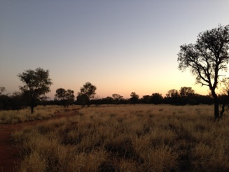
Much later, close to sunset Turuu pulled up in the middle of a rubble plain. This would be our camping spot for the night, and we learnt the last of the Gobi for this trip. It was a spectacular spot. A sand, Saxel and camel dung plain, with Ikh Bogd standing impressively to the south, and the peaks of Khangai Nuruu national park to our north. We hurried to pitch our tents, and ready ourselves to watch the sun set perfectly framed by the scene around us. Some clouds had come over from the North East and were now glowing with an almost fluorescent pink. Our last full day in the Gobi.
* Mongolia has a high elevation and the starting point of our walk was approximately 2,500m.
I woke to watch the sun rise on that same plain. I don't think I'll ever get over the peacefulness that this green desert offers. Its wide and open sky that I've felt I could drown in, the broad and far horizons that have given me space to breath, and the pace of our lives here that has given time to acknowledge these things.
As we carried on our road again the terrain kept changing. We camped by a waterfall, rode through a forest and swam in a river. The weather became colder and fires were lit in the Gers in which we stayed. We met some part-wild horses with zebra-stripped legs and watched the Yaks milked who provided the cream for a clotted cream tea.
We stopped for a while to visit KharKhoum*, the ancient capital of Mongolia, and the still practicing Bhuddist temple there. The long walled grounds of the temple seem to suggest the scale of the country, and in the monks' peaceful defiance and survival, something of the bleak beauty.
On one warm and handsome day, close to the end of our trip, we stopped to lunch near a Ger surrounded by smooth green hills that were crested with gleaming white ridges. I took a twenty minute walk up to one of them. As I reached the top an eagle lifted off from his perch above me and soared off into the blue. I watched him climb through the sky and then myself climbed up the rock to see the land from his view.
In the next days I would travel back to Beijing on the Trans-Mongolian Express. I would spend some days in that city visiting museums and galleries. I would take a hike along the Great Wall of China, built to protect dynasty after dynasty from the Mongolian hoards**. Within a week I would be flying to Melbourne and beginning a new search for markers, boundaries, and routes through another wide land. How quiet and still it was to just stand on that bright white outcrop in the Mongolian sun looking after the eagle who had now flown out of the reach of my eyes.
* and the name of my favourite Mongolian beer.
** a fact that many Mongolians I met were still laughing at.
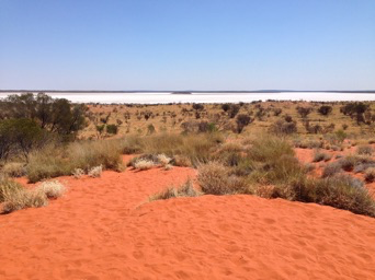
Australia. How BIG is Australia?!? Flying from Melbourne Tullamarine to Uluru, Connellan Airport takes three hours, and that's only half of it!
The flight took us over white salt lakes and dry dry orange land. At first this landscape appeared to be gridded by lines denoting cattle grazing and ownership, but there was a point where the rectangles of land division ceased and the neverendingness of the landscape felt more apparent. It was a surprise and relief when this happened. Since leaving the Gobi I had been itching to be back in large open space... Unfortunately I was to discover that it would be a while yet before I found that again.
Nevertheless, in my naïve state aboard this flight to the 'Red Centre', I was able to look down upon the Australian outback and feel enthusiastic about where I was headed.
Something that particularly struck me was how the scrub appeared from this perspective. So many green-blue circles of varying sizes covered the land. I didn't yet know the names of these plants, beyond the (to me) mystical Mulga and Spinifex, that I'd read about in Robyn Davidson's Tracks. It seemed instantaneous and obvious to relate the multitude of these circles on the land to the dots of the traditional paintings of Australia's first people*, regardless of how little I understood about the flora of this land, or artwork. Later on, while I was staying in Alice Springs, I was told by the curator at Papunya Tula Gallery that dot marks are often used as a filler for a composition. It didn't feel as though they were filler from this distant arial composition. Rather that they helped give definition to the burnt surface I was looking down on. Denser groupings of these bushes and trees gave a sensation of a greater rise and fall in the terrain than was actually present, suggesting some kind of rhythm or flow.
Landing at Connellan and then taking a shuttle to Yulara, or Ayres Rock Resort as it is still called, was a very real coming down to earth from. I was unprepared for a real-life Lassiter's.
The Yulara resort is listed as a town or village, which is where I got confused. This is no village that I understand, with independent retailers and accommodation providers. With easy movement in and out and inhabitants who might share their insights of where to get the best coffee and how to have the most economical visit. This was The Prisoner meets Neighbours. All was beige. There were timetabled Bush Yarns, Tribal Dancing and Dot Painting Workshops. There was a BYO barbecue, but you are only allowed to buy your cooking fodder from the bar that runs the electric BBQs. Contemporary easy-listening covers were piped everywhere from 7am to 11pm, and were occasionally replaced by a live version of the same thing. It was possible to 'escape' to the TV Lounge & Reading Room (why are they the same thing???) or to an outdoor Uluru lookout sand hill. I confess there was a pool, which I used and enjoyed, as it was practically empty from being apparently too cold.
Access to the Uluru - Kata Tjuta National Park is a reasonable $25 for three consecutive days, however physically accessing the park from the 'village' is a most unreasonable matter. Particularly for a solo traveller using public transport. All options for access to the famous and important rocks were tour-based and expensive. I just couldn't believe this was the case, particularly after the ease of accessing The Great Wall in China. I felt locked-down. I could have cried, in fact I think I might have done.
So, I decided to head to Alice Springs, where I felt sure I'd meet other travellers who would have experience and knowledge that I could tap into.
Travel to Alice was only possible via yet another 'tour'. So $160 for the six hour coach journey later I was on my way to the fabled town, just happy to be getting far away from Yulara and safe in the knowledge that a lifetime of travel between west Cornwall and London on trusty British coach and rail services will have prepared me well for this journey through the hot red sand of the Northern Territory on a package holiday coach that doubled up as the local ride. I was realising quite quickly that the boundaries and markers of this journey in Australia would be quite different to those I found in Mongolia. And that I would also need to draw upon and develop a whole different set of skills for navigation.
* The minute you arrive in the 'Red Centre' you begin to be bombarded by dot-painting prints on everything and anything you can think of. Authenticity is a whole other conversation full, unsurprisingly, of questions and contradictory answers. I can't help but think about culture and even day-to-day life things being for sale in my own culture. Who has ended up owning what, and how the hell do you get it back once it's been given/taken? Is it possible to police who accesses your own culture? And if you choose (is it even a choice) to use it to make some money then are you selling yourself? And would you recognise what was yours if someone else tried to sell it back to you? All these questions became far more 'in-my-face' in the centre of Australia than they ever were in the desert of Mongolia.
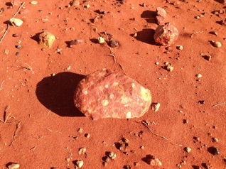
The Desert Oak or Allocasuarina decaisneana
I came across these trees standing up straight and proud, like skinny black leafless lines against the brilliance of the desert. They're hunting for water when in this state, their roots drilling down through the hard earth for many metres. So they're no indicator of any water that's accessible to humans.
A woman, who was cooking huge vats of curried dinners in the Yulara village canteen for teens on a school trip, told me with pride how efficient these trees are. They won't flourish until they find water. Until then they focus all their energy below the surface of the earth, so they appear lifeless, limp and to some ugly. Once they get to that much needed moisture however, and they begin to bloom. Spindly arms growing stronger and sprouting further arms and fingers. They begin to develop some green and then they resemble lollipops, whose sugared candy can sway in the wind.
Mick, a man who was driving a minibus from Yulara to Uluru and back, told the bus load of tourists that the Desert Oak didn't resemble an English Oak, but that "we're Australian and we can call it what the f*ck we like", which I thought was reasonable. He also told me that he hadn't "pissed for fifteen years", he was demonstrating that you should only need to sip enough water through the day to keep you hydrated, not enough to make you pee a lot. Although, after a pause, he said that he may have told me a lie. So for all I know he might even have been weeing all that morning!
Alice Springs
A few things about Alice Springs seemed strange to me on arrival. Among the things that first struck me were the restrictive alcohol licensing and the seemingly very divided communities of the town. Mainly the difference of indigenous and, predominantly white, post-colonisation settler communities. It felt like two towns living on top of each other. As though those in either community would go about their business regardless of the other, they could have been ghosts to each other. Maybe they were, I wasn't there long enough to discover. But the obvious split in the town, on the face of it at least was stark. Many of those staying in my hostel on Meuller Street experienced the same strange sensation of being an observer to this behaviour of otherness. We tried to find out what we could, but I think more time in the town is the answer, and we were all on limited 'tourist-time'. Ourselves adding another layer to the structure of the town's inhabitants.
After a few days I managed to settle into a rhythm with Alice. I visited the library each day for research and a quiet work space, I visited galleries, art centres, and the museum. And I tried to find a way to access the bush.
I'd hoped that I'd find fellow travellers in Alice who were equally frustrated by the lack of options for accessing the desert. That people would be inventive and group together to beat the system of tour operators. I did meet Monika, an energetic and forceful woman from Köln, who was as determined as I to travel independent of facilitation. We researched routes and 4wheeldrive deals. Devised a trip and made posters for hostels and posted on Facebook pages, Gumtree and other traveller sites, looking for fellows to join us out into the yonder. None answered. We worked out that others, less dreamily hopeful than ourselves, had realised the lock down and so booked onto the best value tour for their needs before they'd arrived in Alice. Itineraries were organised and alteration would be costly.
I myself had fallen foul of this by anxiously booking my flight to Sydney from Yulara ahead of time to avoid price hikes, thereby limiting my options for joining other trips out into the red. For instance a German fruit-picker who had driven over from Queensland in his fifth-hand station wagon, or even Monika. Who was joining Alice-based friends she'd made on the way down from Darwin to do some work towards the Freedom Flotilla: Lake Eyre to West Papua* project.
As these people made their way in their own directions I, left again to my own devices, thought about how I could look for the space I wanted, and find the wizard dynamic that would stretch out into the hot bright blue.
There were a series of walks from the town into the bush around the Telegraph Station. I took to walking some of these, following bike tracks for a few kilometres, close to the beginning of the famous Larapinta Trail. These trips gave me quiet space, and an introduction to the sounds of the lizards, birds and insects here, and of my own crunching footsteps. There was no flatness during these walks. Rocky dirt gullies, low ridges and dry sandy riverbeds were the terrain. I aimed to be done by noon each day as the heat would grow harsher as the day wore on, and my rucksack heavier. I dripped with the sweat of not a great deal of labour, and felt that rather than drinking my water I might as well have just thrown it over myself. The colour and heat of the walks, however, gave me energy and a sense of being on a road to where I wanted to be.
Later in the week I chose to take an organised trip out to the Kangaroo Sanctuary**, run by Brolga, to get a bit further out of town and learn more of the habits of Kangaroos and Wallabies. The positive attitude of that place where I watched the sun set over the red, blue, green of the Alice outback, coupled with Brolga's determination to make a difference, restored some wonder and faith to my hunt. Maybe there was a new way that the molluscs and wizards would flex their muscles and introduce me to their modes of action in this land. In this giant island that is so different and yet so similar to my own.
*Inspiring and energetic the Freedom Flotilla took waters from Lake Eyre to West Papua, in an act of solidarity and positivity. The waters of Lake Eyre are told to originate from rain falling upon West Papua and therefore represent a bonding of land, life and people. You can find out more about the campaign here, www.freedomflotillawestpapua.org, as they continue to raise awareness of the oppression of the Indonesian occupation of West Papua.
**the sanctuary was set-up and is run by Brolga's of BBC Kangaroo Dundee fame. He's very tall, and very dedicated to spreading an understanding of how Joeys can be saved from starving in their dead mothers' pouches, by passing motorists just stopping to take a look. You can find him on Facebook to hear regular stories about the sanctuary.
Lassiters
Loaded up back and front with rucksacks I walked to my 6:40am coach pick-up to travel back to the Yulara village. I had swallowed my pride and accepted a fate of sorts.
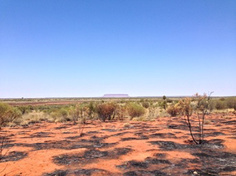
Journeying back South down the Stuart and Lassiter Highways it struck me that this time, I was better informed about the landscape I was passing through. I had walked upon it, had spoken with people who lived by its codes, had read and heard stories (scientific and cultural) about its formation and viewed artwork that referenced it. My sense of its huge capacity for eliciting notions of freedom was growing. This time, travelling through the land of salt lakes and mammoth rocks, I was excited. The next morning would be an earlier rise and I would finally make my visit to the Uluru Kata Tjuta National Park.
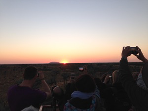
I would have two whole days at Yulara. The morning of the first would allow me a walk through the mounds of Kata Tjuta, but all of the second, from sunrise to sunset, would be spent at Uluru. Finding the most affordable route or way of doing something had become one of the guiding points of this stage of my journey, as was finding ways to be alone in my walking. It required research through visiting tourist information points, libraries and websites, as well as incidentally, through talking to people and asking questions in shops, hostels, bars or on buses. I was always ready to learn something that might be helpful to my journey. Unfortunately I also found that there were often people or systems ready to block the most solitary or affordable path, but I treated these blocks as part of the terrain and substance of the trip, and I navigated them as such.
I had discovered a company* that offered straight forward return trips to both Kata Tjuta and Uluru. For the first day's trip I would be taken at sunrise in a mini-bus with other tourists from Yulara to a viewing platform within the national park where we would be given 40 minutes to watch the sun rise behind Uluru and cast its warm glow on the the turtle forms of Kata Tjuta. We would then be taken to Kata Tjuta and left for four hours to walk through, what has been named, The Valley of the Winds. A narrow 'jurassic' valley that opens up to a vista of plains. Standing in it I was reminded of savannah that I've only ever read of, or seen through TV and film, which did threaten to hijack my imagination and override the current experience. But in the end what was happening in the now, filling my eyes and ears and burning itself into my skin was more powerful than the these borrowed memories.
*Mick's bus, of my Desert Oak posting.
Minga
** Minga - ant in Pitjantjatjara, name for tourists who climb Uluru
1. Small black ant. 2. Cover term for various species of ant, ants in general. 3. (Uluru Slang) tourists.
Minga alatjitu, (lit. Just like ants!) used to emphasise the huge size of a crowd or other gathering: Anangu winki nyinangi - minga alatjitu! There were so many people there - teeming like ants!
Minga pulka, lots of ants (pulka 'big')
I learnt about this term from the ranger when when I spent the day at Uluru. What fascinated me most about the term Minga was that in Cornwall a common term for tourist is Emmet, a Cornish dialect word for ant. It's not that surprising that two cultures from opposing sides of the world should relate the movements of swarms of tourists to those of the ants that invade store cupboards and use any crack or crevice to their advantage, but learning about it gave me a more of an understanding of how I was trying to access the land of this country and where my approach to path-finding was coming from.
Uluru
Tuesday 30th September: A little after sunrise I began the 10.6 km walk around the base of Uluru, choosing to go anti-clockwise in some hope that I'd have more space for myself. I took my time, stopping often to watch birds and investigate the nooks and crannies of the rock. It's apparently quite common for first time visitors to expect an almost perfectly smooth and even surface to the desert behemoth. It is anything but. As I walked its circumference I quickly became aware of it being a form of folds and movement, with water and its traces everywhere.
There were many places to find information about the formation of Uluru; Mick the minibus driver, the Ranger at the Cultural Centre, the museum in the Cultural Centre, and then hearsay from Alice to Melbourne ere was always someone with a new nugget to share. I was told that the rock had at some point turned. That a number of cavities on one side of it were made by water running and filtering through it. That these holes that pepper just one side of the rock were at one time beneath it. I was also told that it was like an iceberg, with at least twice its mass beneath the surface of the earth and therefore not visible to us at present. That upon its top are watering holes and small areas of woodland and bush, fed by rainwater. Walking around Uluru's ground level belt it's possible to walk into some of its rock folds and within them find watering holes fed by waterfalls that add credence to the tale of green worlds on its uppermost surface. Green worlds that I cannot substantiate as I will not climb the rock to see them*. I do sit and walk in caves perhaps created by long past rushing waters, and which are inscribed with detailed instruction to youths on hunting and other life pursuits. Their floors telling a story of domesticity, scars of grain and seed grinding and scorching from long past fires.
All of the above added to the sensation of this rock being a planet of its own. Spinning slowly, when timed by the evolutions of the Earth, but perhaps at just the right speed for itself. Sitting snugly in the desert like a baring in a wheel that minds its business and does all that it needs.
I had chosen that I would spend the day at Uluru. The minibus would collect me at sunset, and so I had the time to take my time, to view the rock from the corner of my eye, from a cafe window, over the top of my book, whilst talking to a fellow tourist, whilst coming out of the loo. I was there for a day. I had no familiarity with the place. But I felt like I allowed myself the time to be slow with it and to be a little bit mundane, because when you're confined to the only shade around for six hours you forget to be alert and wowed at what is right next to you. And with that normality, and with water and shade becoming of greater importance than the spectacle, I feel like I may have been able to experience Uluru as just another piece of the Earth that is no more special than the granite of home but that with its size can remind of the importance of all those seemingly smaller parts.
At the end of my day I waited outside in the warmth of evening sun chatting to a suave and alert American Europhile who put me in mind of Peter O’Toole in Lawrence of Arablia. The minibus would collect me at 5:45pm, but until then I shared a warm conversation about the strangeness of the Yulara holiday village, of the majesty of Uluru and of the wonder of solo travel, of the time and peace it gives and of the short but life imprinting engagements one can have.
Dining tables were laid out in front of the Cultural Centre with white linen and silver cutlery. Uluru stood as a solid backdrop, but to itself I suspect the evening that was being prepared was no more affecting than a small meeting of ants on the surface of a sun-warmed piece of granite. Mick and the minibus arrived, and I headed off to a sunset viewing platform to observe the famous changing colours of Uluru in the fading light of the day. Lawrence remained at the Cultural Centre to drink chilled Champagne and eat what he recognised would be a very European meal in the heart of this very non-European place. And I thought about the seemingly harmless treats we allow ourselves and how historic paths can be reaffirmed by actions in the present.
* it is requested by the people of the land that visitors do not climb Uluru as it is a sacred place.
Molluscs Hunt Wizards is an ongoing project as part of Symbol Archive
BACK